 |
| MapKit, obviously. |
Internally the toolkit won't ever be more like MapKit. But we can pretend in a couple of ways: Overlays and Interfaces.
MapKit Overlay
MapKit provides overlay options for everything from markers to tiled image sources. Annotations are super flexible, but very slow beyond a handful. And don't even think about animated tile sources. Ouch.
For some data sources it's going to be easier to render in WhirlyGlobe-Maply and slap the results on top of MapKit's UIView.
 |
| It's not topical, I just like MapKit's stations. |
That's the solution. We'll track what MapKit is up to, at least in flat map mode, and overlay our own rendering to match. Think weather apps.
MapKit Interfaces
MapKit has a nice collection of interfaces for adding annotations, great circles, and all sorts of other good stuff. We'll try to be more compatible with those.
 |
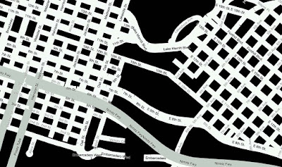
| Portland in MapKit. Why not? |
This means methods that take MKMapPoint or CLLocationCoordinate2D objects. It means init calls that are similar to the MapKit equivalents. And yes, it means working in (shudder) degrees.
The goal here is a simpler conversion from a MapKit app to a WhirlyGlobe-Maply app.
UIView vs UIViewController
This one really bugs a handful of developers. Our main interfaces are derived from UIViewController rather than UIView.
View Controllers are nice because they have life cycle events. You have to wire all that up yourself in a UIView. But it's possible and we'll do it because we know you want it.
Roadmap Not Actual Size
That's the plan and this all goes in the base toolkit so it'll be free. But we need money to do it. Always with the money.
As with all our plans, it'll get done eventually. Pieces will go into proposals, clients will step forward, and some of it we'll just do ourselves.
Got feedback? Let us know.


