Wednesday, October 28, 2015

WhirlyGlobe-Maply 2.4 Beta #8

The latest beta (#8) of 2.4 is available.

You have no chance to survive make your time.

You can get this one of three ways.

  • The binary release can be gotten there.
  • Cocoapods can be had directly from this URL or with the tag v2.4_beta8
  • You can just use the repo with the tag v2.4_beta8

That's just the framework.  I'll put together the test app and its data when the release is ready.

"Did I miss betas number 1 through 7?" you may be thinking.  Yeah, pretty much.  I made them for clients, but haven't been aggressively pushing them on users.

What's New In Beta #8


Well, it's all new to 2.4, so go check out the announcement post.

I am repeating myself, yes.

The pretty stuff is pretty, but the stability of 2.4 is really profound.  We've been integrating with a number of high traffic apps and have cleared up a lot of edge, corner, and middle cases.  This is a great release.

How Many More Betas


Probably just the one more beta.  Things are nicely stable and I've got a pretty short list of bugs I want to fix.  

After that, it's WhirlyGlobe-Maply 2.4.1 which... okay I'm already working on.

Friday, October 9, 2015

WhirlyGlobe-Maply 2.4 Features

There's a lot of cool stuff in WhirlyGlobe-Maply 2.4.  It's been about a year since 2.3, so there'd better be.

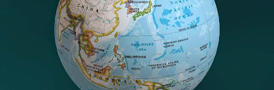
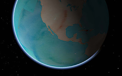
Stamen Watercolor + atmosphere = Wha?
Let's start with the popular stuff, move on to the pretty stuff and then round it up with everything else.

Basemaps


Remotely pageable image basemaps are the single most used feature in the toolkit.  Version 2.4 introduces a new way to specify them.  Rather than use the base URL and let the toolkit figure out how to add the level, x and y you can just tell it.


Give the MaplyRemoteTile source a URL with {x}, {y} and {z} in it.  We'll just replace the level {z} and the location {x} and {y} with the tile ID as required.  This means you can shove whatever other junk you need into that URL, like your access token.  Take a look at this tutorial for an example.

Cocoapods


The Podspec is back, at least in beta form.  You can find a WhirlyGlobe.podspec in the develop branch and, in combination with a tag (v2.4_beta8) you can use it right now.  I'll update the official one when we release.

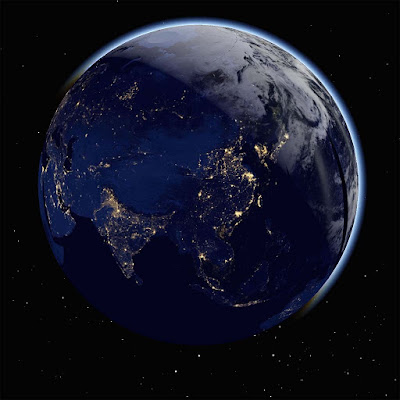
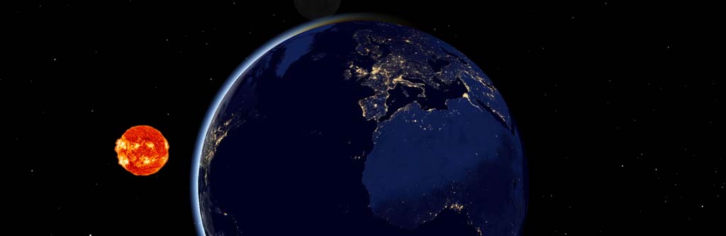
Atmosphere & Night/Day Shading


You'd think I'd have done atmosphere long ago.  You'd be wrong, it's not all that useful.  But it sure looks cool!  And, okay, hardware is a lot faster now.

It does look cool, I'll admit.
There's a new shader for when you're zoomed out and one for the ground itself.  I can add the shader you need when you're zoomed way in looking toward the horizon if necessary.  And by necessary, I mean I accept cash and checks.

The night/day shading requires two sets of image basemaps.  You can see the ones I'm using the ComponentTester app.  Just turn on the "Stars and Sun" and "Night/Day Images - Remote".  Which brings us to....

Stars, Sun & Moon


That's right, you can show the sun, moon, and stars in their (maybe) correct positions.  I'm reasonably certain about the sun, less so about the moon and not so much on the stars.  It sure does look cool, though.

We're all going to die!
You might want to supply your own sun texture if mine doesn't amuse you.  It amuses me.  Consult the Component Tester app for the details.

Some of these features are cheap to run, some aren't.  For full atmosphere, you'll want some decent hardware for the fragment shaders.  Please don't overuse them.  I know you'll overuse them.

Particle Systems


We've got particle systems now!  They look awesome!  I have no examples I can show you!  Because client!

This is one of those advanced features, I'm afraid.  Drawing them is easy enough, but feeding them is work.  We're planning a nice example for the next version.

Elevation


This is another one of those cool features that people love, but rarely have money to pay for.  Well, someone finally did, so here you go.

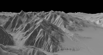
It's just very gray right there.  Desert or something.

Specifically, this is support for Cesium's mesh terrain format.  You can get that from them and I like how it's structured.

At this point we just have elevation.  Cesium structures its terrain in a different tiling system from everything else, so we can't overlay images.  Future version, I think.

3D Models


The toolkit has support for true 3D models now, particularly Wavefront OBJ, a file format old enough to vote.  Obviously something newer would be nice.  Again, send your requests in the form of cash or check.


In addition to the model support, we can now do proper OpenGL ES based instancing.  This means you can have a bunch of these things moving around without using up all your memory.  And they can move, but more on that later.

There's also support for raw geometry.  If you can't specify your geometry through one of the standard ways, you can just start throwing triangles at the toolkit.  Obviously an advanced feature.

Shapes


3D shapes are like models, but much simpler.  This version added extruded shapes, which is nice for things like arrows.

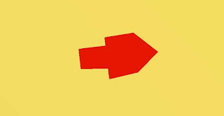
Shading.  Is a thing that could use work.
You can control the location and orientation of shapes more precisely now too, with direct access to the matrix.  Shapes can, in some cases, be converted to models.  That's useful if you have a lot of them and want to make use of the model instancing optimizations.

Motion


Used to be you had to remove and add the same object repeatedly to make it move.  That's fine for one or two objects, but what about 2000?

Screen markers & labels in 2D and models and shapes in 3D all have Motion variants that take end points and durations.  In combination with the new fade and enable times, you can do some tricky, tricky things.

If you're moving one or two objects, don't bother with this.  If you're moving a few thousand, it's useful.  The motion is shader based, making it very efficient.

Animation State & Viewpoint Control


Controlling where the user is looking at has been annoying in the toolkit, particularly when heading and tilt are involved.  Now you can control it very precisely, even animate it.

Take a look at the WhirlyGlobeViewControllerAnimationState in the WhirlyGlobeViewController.  There are methods for getting and setting that state, as well as animating and interpolating between states.  There's even a delegate for doing your own animations.

Mapbox Vector Tiles


There's been a lot of work on Mapbox Vector Tiles, but it's advanced stuff.  I'll write up a user's guide to their vector tiles with WhirlyGlobe-Maply... one of these days.  You can use them, with a lot of caveats.

Courtesy National Geographic.
As a transport mechanism, the toolkit can handle some pretty interesting stuff, like vectors and images.  We're doing that with National Geographic World Atlas.

Styles are more complex.  Right now you can specify a style sheet with Mapnik XML, which is a little hard to work with.  Mapbox GL Style sheets are partially implemented, but that format is in flux right now.

It's very much for advanced users at the moment.  I'd like to change that in the future.

Performance & Twiddly Stuff

There are a bunch of features which, while important, are very boring if you're not writing a big, complicated app.  Course, those are my customers, so let's dive in.

Texture atlases have been in there for a while, but now they're exposed at the high level.  Take a look at the addTexture:desc:mode: method in the WhirlyGlobeBaseViewController.  That's a rather flexible way to add textures standalone or to the atlas and replaces all the other addTexture methods.  And texture atlases are very, very fast.

Billboards have been in there for a while, but can now be specified with a MaplyScreenObject. With that, you control the layout and use text that taps directly into the glyph engine.  Fast & memory efficient.  Expect to see more use of MaplyScreenObjects in the future.

Getting close to the ground has always been a problem, but it should be no more.  There were a variety of centering and offset fixes for a variety of visible features.

Selection supports absolutely everything now, from moving labels to polytopes to 3D model instances.  Not a lot of fun to write, but important.

Most objects now support vertex attributes.  You can send these along for the ride through the system and then read them in your own custom MaplyShaders.  For the handful of you that write custom shaders, use it for passing in things like height and then shading based on elevation.

Widened vectors have been in there a while, but they're not heavily used outside of vector tiled maps.  There are some improvements and bug fixes that should help.

Screen based texture application is now available.  That makes texture application for an areal feature look logical in the 2D display.

Absolutely everything is thread safe (probably).  My high end users make heavy, heavy use of dispatch queues so you can hit the toolkit from just about anywhere now.  If you're chasing performance, do your adding and removal in a dispatch queue, or several.  The toolkit can handle it and it works well on anything newer than an iPhone4.

Crashes & Bug Fixes


Version 2.4 includes a veritable metric ton of fixes for layer teardown, view controller teardown, dispatch queue teardown (or lack thereof) and all sorts of other weird corner cases.  Thanks to everyone who gave me access to their Crashlytics accounts!  Yes, I know it's called Fabric now, but that's a dumb name.

One bug a lot of you had seen is the BigDrawable crash.  Turns out that was related to running low on memory, but was not caused by running out of memory.  Despite my attempts to deny it, it was real and it's now fixed.

Conclusion


That's about it for 2.4.  It's a huge release and it's taken far too long for me to get it out.  Let's see if we can do better next year, eh?

And the best way to make that happen is to buy a Support Contract!  If I get a few more signups, I'll start doing nightly builds and try out monthly releases.

Thursday, August 20, 2015

Cesium.js Terrain Support

We've been adding support for one of Cesium's terrain formats recently.  Cesium, if you don't know it, is similar to WhirlyGlobe-Maply, but for the web.


Our toolkit has its own gridded terrain format, but I'd rather use someone else's.  Cesium has a better thought out and much more expansive set of terrain formats and tools available.

I was recently invited to discuss it at a Cesium meeting in Los Angeles.

SIGGRAPH Presentation


I used to attend to SIGGRAPH religiously, but I haven't been back in years.  It was a blast to walk the exhibition and see what's new.  Lots, of course, but a lot still looks the same.  Heck, it still smells the same.  No no, not that way.  It's the air conditioning and the projection displays.

Anyway, I gave a short presentation at Cesium's Birds of a Feather meeting last week.  Slides can be found here.

The Short Version


But what you're probably wondering (if you're still reading) is how well does the Cesium terrain work?

It's a start
Cesium has a funky way of representing terrain tiles that don't match to your standard TMS/Google/OpenStreetMap/Mapbox view of the world.  So we can't overlay those data sets on top.  This is limiting.

The Future!


Obviously, I'd like to fix that.  We'll need to do some resampling of image tiles as they come in to match the Cesium terrain.  It'll be a bit slower, but simple enough for the user.

So for now, you can show Cesium terrain, but without images on top.  If you'd like to fix that, hey it's open source, go for it.  Or you can wait until someone pays us to do that.  I suspect it'll happen in the next few months.

Friday, August 14, 2015

Revisiting Support for WhirlyGlobe-Maply

A few months ago I introduced a support contract for WhirlyGlobe-Maply.  $600 USD for all the questions and bug fixes on the iOS version.

Nice 'stache, Australia

I like how support has turned out, but I need to make some tweaks.  But first up, who uses the toolkit?

Who Are The Users Anyway?


I had the image of a lone hobbyist beavering away at their personal project.  Yeah... not so much.  There are a few hobbyists, and they're cool, but they're rare.

So who is using it?  It's the serious app developers.  People doing it for a living, often part of a big corporation or at least something with revenue.  Organizations, if you will, who can afford to pay for things.

So You're Raising Prices?


Oh yeah.  I'm raising prices.  I'm spending more hours on support than I'm getting back in revenue and I'm not getting the overhead time I was after.

Support will now be $950/year.  I came up with that number by looking at hours spent, the number of contracts, and the desire to keep it a three digit number.

The support thing is working out well in every other way.  Seeing what people need and how they use it is really great.  And I've learned something really vital: people can write apps without me.

Wait?  The Toolkit Actually Works?


I know, right?  You could always write simple apps without me.  Now you can write big, complex ones without me.  WhirlyGlobe-Maply <sniff> is all grown up </sniff>.

HTML jokes.  Right below puns on the humor scale.

But I don't mind.  Not needing me is excellent!

So You're Going Broke, Then? 


Happily, no.  mousebird consulting (inc!) has business in the queue through early 2016.  We've just passed the revenue number for 2014.  Like, just a few days ago.

To pull that off, I've found a happy medium between pure toolkit features and whole app development.  Sort of whole module development, if you will.

What About Android?


Support is just for iOS at the moment.  See, the iOS version works more or less like it claims and I can fix any bugs that crop up.  The Android version isn't there yet.

It'll get there.  I've got big clients pushing big projects out on Android.  So it'll get there.

More!  I want more!


Okay, okay.  Fine.  How about this.  If I get 10 new support contracts by the end of 2015 I will set up automatic daily builds, some simple unit tests, and try monthly releases.  We'll have to see how that last one goes.

Plus, hey, features.

2.4: Day/night Shader + Atmosphere + Stars = Daaaaaamn

WhirlyGlobe-Maply 2.4 is almost out the door.  Beta5 just went up the other day and it is a scorcher.  Wow.  The stuff that's in 2.4 is just... daunting.  To write up, anyway.  I'm way behind.

Bored Now.  Wrap it up!


If you've already started talking to me about a support contract, you're grandfathered in at the old price.  Renewals will be a bit higher, but won't go all the way up to the new price.

Everyone new pays the new price.  But look at the benefits!  People are writing actual complex apps with just the support contract.  So can you!

Wednesday, June 17, 2015

GeoSpatialKit - A suggestion for Apple

I spent last week at WWDC in San Francisco.  Not too much new, but I saw a lot of performance and optimization in iOS9.  I spend a lot of time on those myself, so I approve.

But Apple's geospatial support is still... mediocre, particular given what they must be paying for the map.  I got to thinking:  What would make geospatial display work better on iOS and OS/X?

First, what am I talking about?

Geospatial Is....


Geospatial data display is maps and globes.  A weather app is a geospatial app, as is any sort of map app and so is an Atlas.

Globe, map.  Map, globe.  Same thing.

Geospatial is what I do.   I make a popular toolkit for map and globe data display on iOS (and <cough> Android </cough>).  Presenting geospatial display to developers in a way they can handle is what I do.

And that leads to the important question:  What's wrong with the way Apple does it now?

The Current Situation on iOS (and OS/X)


Let's use weather as an example.  Everyone loves (or hates) their weather app.  In any case, they have an opinion.  So how do you make a serious weather app, with animated radar and such?

You build a serious weather app in one of two ways:  Core Graphics or OpenGL ES.  You can tell which was used immediately.  Is it a little weird and janky (Core Graphics) or smooth and pretty (OpenGL)?

Why that is has a little to do with rendering and a lot to do with data management.  The way you display 20 pins in UIViews is not the way you render 20 layers of animated streaming radar data.

And okay, that's a hard case, but it's also plain old map apps that are kind of 'meh' under Core Graphics.  There's another reason for that.


MapKit Under Glass


The Maps App is a big, capable and (I imagine) very expensive system.  It does a lot and it's pretty good at it.  MapKit looks to be a sort of wrapper on top of it.  That's a problem.

Hands up.  Who's reimplemented that compass?

You can't change the bulk of what MapKit is displaying.  Sure, you've got a few knobs to twiddle and you can toss a little of your data on top, but only grudgingly.   But there's an even bigger issue.  MapKit was obviously (obviously!) written with OpenGL ES, but none of that infrastructure is available to the rest of us.

So here's the question.  If you scooped out MapKit's brains and made neat little piles, what would that (unfortunate metaphor) look like?

CATiledLayer Revisited


I think you'd start with CATiledLayer, the go-to data structure for the pre-OpenGL map era.  As a reminder, CATiledLayer will break the world into little pieces and tell you when to load those pieces.

Something like this

A new CATiledLayer is a good place to start, but it's probably a bit low level and it's missing one giant thing: A Spatial Reference System.

Adding an SRS to a CATiledLayer(-like thing) would solve the first set of problems.  Your data could exist in one system while displaying in another.  I'd also make the levels and loading strategies explicit with budgets for tiles and such.  And threads everywhere.  EVERYWHERE.

One tile loading strategy

That helps with loading, but what do you do once you've got that little image or basket of vectors for a tile.  How do you render it fast?

With Core Graphics, you really don't render it fast.  And the layer based image solutions are kind of weak.  It's time to drill a hole in UIKit and plunge into the icy waters of OpenGL ES.

Images, Vectors, and Shaders - Oh My!


Most of what you want to display on a map is pretty simple:  Image tiles, symbols, text, lines, and polygons.  All pretty easy to display slow, but hard to render fast.

Sometimes a map is just a map

Here's what you do.  You develop a little system for abstracting those object types to hand to a renderer.  Then let the system manage them, batch them and move them around.  Essentially you've moved the developers job off into other threads:  Just load the data and let the system handle it.

This is suspiciously similar to what I do in WhirlyGlobe-Maply.

What About The Globe?


Well, yes, everyone loves the globe; even developers who should know better.  User interaction with a globe is just different from a map and switching between the two makes life harder than it needs to be (looking at you MapKit).

Globe + Weather = Awesome

But the globe is cool, so where do you put it?  SceneKit.  SceneKit is where you put it.

Pull the tile loading logic from CATiledLayer++ above, make a nice globe surface and voila!  You can reuse most of what you build for the 2D maps.  Sure, it's a little more work to set up SceneKit and live in OpenGL-land.  But globe.

Aaaaand back to MapKit


Okay, so you've built up a nice rendering infrastructure for map tiles, vectors, symbols and other such stuff.  It gets along with both UIViews and SceneKit.  But does it use anything from MapKit?  It also begs the question:  Should you rewrite MapKit in this stuff?  

No.  Good grief, no.  Only interns and the criminally insane rewrite working systems for the hell of it.  Instead, you steal data from the map.

Nothing personal, Santa Rosa

Apple Maps has a number of interesting data layers it would be fantastic to reuse in other apps:  Roads, water, symbols, land, parks, and labels to name a few.  Especially labels, which would make one of my dreams come true:  Putting the @%&#@ labels on top of the animated radar.

Map Data Reuse


Mere mortals can't reuse Apple Maps data... but Apple could.  If they started teasing it apart and tossing it into a system like I've described above, it would make maps apps that much more interesting.  And yes, the label thing, which bugs me a lot.  Seriously, that's annoying.

Missouri?  Maybe?

This would also let us mix and match data from varying sources.  There are some excellent map tiles out there and I'm sure Apple could come up with a few more of its own that don't quite belong in what they've got now.

Wrapping it Up


I've skipped over a few details, but here's the basic story.
  • Add a Spatial Reference System for selected layers
  • Soup up CATiledLayer for some serious tile management
  • Drill a hole down to OpenGL ES (and/or Metal) for some decent primitive display.
  • Globe meet SceneKit.  SceneKit, globe.
  • Start pulling data layers out of the map source.

Do that, Apple, and you've got yourself some seriously reusable geospatial display support.  It would be interesting to see what came of it.

Actually, feel free to not do that.  It would put a crimp in my WhirlyGlobe-Maply business.

Sunday, June 7, 2015

WhirlyGlobe-Maply Contract Job

I've got a short term contract available for the right person.  I need you to run through the tutorials, looking for errors.


The best thing about this:  You don't have to be an iOS expert!  In fact, it's better if you're not.

Tutorial Checker


The WhirlyGlobe-Maply tutorials have been a huge boon to beginning users.  But I suspect some of them have errors and spots that are difficult to follow.  I know of a few, but I'd like to find the rest.

That's where you come in.  As a Tutorial Checker you need to have the following:
  • Appropriate Apple hardware and Xcode already installed.
  • Some experience building at least a test app for iOS.
  • Excellent English skills.
  • Be in the US.  I'm not sure how to legally pay people outside the country.
If you've just wrapped up one of those six week code academy things for mobile, that would be absolutely perfect.

What's Next


If you're interested, drop me a line.  You can find my contact info on the WhirlyGlobe-Maply page.  Let me know what your development qualifications are (they can be thin) and we'll talk.

Friday, June 5, 2015

mousebird consulting Needs YOU!

I'm hiring.  If I can find the right person.

It's not relevant, I just like this image.

What We Do


You can read the web site yourself, but here's the tl;dr.  

We do high performance geospatial display for mobile devices.  Our customers include National GeographicForecast.IO and many others.  Our code burns millions of battery hours on millions of devices all over the world.

At any given time we're working on apps in weather, aerospace, education, and mapping.  And lately, all of them.  At once.

What It Is


I need another software developer, primarily.  These are the areas we work in.
  • OpenGL (ES or not)
  • iOS Development, Objective-C
  • Android Development, Java
  • User Interface development
  • C++
  • Geospatial data processing: GDAL, OGR, Proj.4
  • Data processing on Amazon ec2

If you have experience in any three of those, that would be interesting.  If you have experience in all of them... you're probably too expensive, but let's talk.

Where It's At


I'm in San Francisco.  If you are too, you can share the office.  Yes, an actual office with a door and everything.

If you're remote, that's fine.  Our clients are scattered around the world and don't visit much (sniff).  You have to be in the US, though.  I barely understand my own country's employment laws as it is.

What Is Next


Send me a resume, or your github profile, of Snapchat some code or something.  Just let me know if you're interested and we'll figure it out.

I'm open to part time, just returning to the work force, that sort of thing.  The mobile development market is red hot right now and I'm willing to be flexible.

Wednesday, June 3, 2015

Mapzen Vector Tile Service

Let's take a look at Mapzen's vector tile service.  They've recently announced a developer program and done a lot of work behind the scenes.

Sea levels aren't rising!  Shut up!

Vector Tiles


Mapzen is processing the OpenStreetMap planet file into nicely addressable vector tiles.  They provide the recipes for doing this yourself, but my attitude is better their Amazon account than mine.


Of the formats they offer, WhirlyGlobe-Maply supports two:  GeoJSON and PBF (aka Mapbox Vector Tiles).  I prefer the latter.

PBF (or MVT) contains compressed vector data with general attribution.  To make something visual, you have to match the attributes to a style.  In the past I've used Mapnik XML for this, but this time I've gone with something different.

Mapbox GL Style Sheet


Mapbox has been busily developing (yet another) styling format for their vector tiles.  The new format is nicely tuned to display rather than offline rendering.

The main disadvantage with the new format is there's no way to generate the damn things; you just have to edit the JSON directly.  I imagine we're all hoping they'll update Mapbox Studio one of these days.

OSM loves footpaths

But I like the format and it's clearly where this part of the open source community is going.  So I added a parser to WhirlyGlobe-Maply.

Mapzen Data + Mapbox Style + WhirlyGlobe-Maply


We've got the vector data from Mapzen, a style sheet in the Mapbox format and a big real time rendering toolkit.  How hard is it to put it all together?

Not hard at all.  There's a standard tiling loader (not shown) that will read it on the fly (in multiple threads).  We just have to set up the MapzenSource which involves..
  • Reading the MapzenGLStyle file.  It's in the local bundle.
  • Setting up the cache directory, so we're not always hitting Mapzen.
  • Specifying the base URL and API key for forming the Mapzen URL.
  • Picking the layers we want.  All of them in this case, but we could be selective.
  • Using PBF (MVT) for the source and Mapbox GL for the style.

Yup, it really is that simple.  I've been messing around with vector tiles for years now.  I've got it down.

This code is in the WhirlyGlobeComponentTester app in the develop branch on github.  I suggest using it in 2D mode.  Things get a little weird on the globe at lower resolutions.

Performance & Next Steps


It's pretty good on the device.  You could use this in a shipping product.  The style is a little bland, but it's fine for a demo.  Rendering performance is decent, but could be optimized.

Needs more labels
Mapzen's set things up so you can fetch individual layers.  I think it would be interesting to use, say the symbol and labels on top of one of NASA's live data sets.  Somebody go do that and let me know how it looks.

Saturday, May 30, 2015

State -o- The Business and Conferences Galore

I run a little consulting company called mousebird consulting inc. [yep, all lowercase]  We do development on and around the WhirlyGlobe-Maply toolkit.  This pushes new features in the toolkit and, ya know, pays the bills.

[Put gratuitous graphics here]

The toolkit brings in leads, I pursue them, clients sign contracts and invoices are paid.  It's a pleasant arrangement when it's chugging along.

So How's Business?


It's chugging along.  I logged my best month ever in January.  Then I did it again in February and April.  That was a ton of WhirlyGlobe-Maply work, some neat apps, and lots of great new features in 2.4.

The down side is my backlog.  I haven't had much time to track down problems for users who aren't clients, write new documentation, or make the Android version easier to install.

If you need some of my attention, the best way is a support contract.  I have a few of those now and I like how they're playing out.

Conferences


Another downside of so much paying work is a dearth of presentations.  Good ones require time to write and I have no time.

Even so, I'll be on a panel for State Of The Map 2015 in New York next week.  I'll also be at WWDC in San Francisco the next week.  If you want to get together at either, drop me a line.

Monday, April 20, 2015

Old App: FlyQ EFB

Purple rectangles are common at altitude
This is an oldie, but I've just gotten permission to disclose it.  Introducing FlyQ EFB from Seattle Avionics.

Seattle Avionics is actually one of my oldest clients and theirs are among the most complex WhirlyGlobe-Maply apps around.  I've finally talked them into going public with their support for open source!

FlyQ EFB


For those of you unfamiliar with aviation terms (guilty) EFB stands for "Electronic Flight Bag."  

Pilots used to haul a ton of paper charts around and do all sorts of complicated things with them.  PCs and specialized devices replaced much of that and now commodity tablets are changing things again.  Just like in other markets.

If you've ever wondered why WhirlyGlobe-Maply seems to have so many aviation-friendly features, now you know.

Maps, Globes, and True 3D


In FlyQ EFB WG-Maply is largely used as a map.  Even though it's on a globe, everything is plastered to the surface and interactions are almost entirely map like.  

Don't let me anywhere near the controls of a plane.

All of the objects you see on the globe are standard things like screen markers, labels, image layers and so forth.  Organizing the data and passing it to WG-Maply is accomplished in the app, and I can assure you, that's the hard part.


Orange is bad.  It's not orange's fault.

There's also a true 3D mode which is meant to resemble what a pilot might actually see with certain caveats (Look out the window, fool).  This is a little further afield of what WG-Maply is meant for and is tied much more tightly to their app.

Smart Plates & Charts


Seattle Avionics has another app called SmartPlates & Charts.  Think of it as a simpler sibling to FlyQ EFB.  If you're just curious, I'd start here.


It's great to be publicly welcoming Seattle Avionics to the open source family!  If any of you other lurkers want to fess up, let me know.

Thursday, April 16, 2015

New App: National Geographic World Atlas

WhirlyGlobe-Maply is now at the heart of the National Geographic's World Atlas iOS app.

And why not Belgium? (tm)


I plan on being insufferable for a week and then smug for another two months.

The App


It's gorgeous, just go buy it.  You may already have it, lots of people do.  NatGeo provided 4.0 as an update, which is really nice of them actually.


The Technology


There's some really interesting stuff going on with the globe.  For instance doesn't that text look suspiciously... sharp?

Did you know Vatican City is its own country?  Of course you did

We'll talk more about the process later, but let's just say it involves: PDF, Mapbox, hybrid raster/vector tiles, on-device font glyph rendering and lots of math.  Getting that classic NatGeo map look on mobile, but better, was interesting.

The People


I just did the globe.  Rally Interactive did the bulk of the user interface and it's gorgeous.  Mapbox helped out on the data processing and storage side.  National Geographic did some of the development and all the data (of course) as well as the project management.  That last one was some serious work.

That'd hurt if you picked it up.

It was a pleasure working with Rally and NGS.  It's a hell of an app and I hope the users love it.

Monday, March 16, 2015

New App: Epicenter

Earthquake apps are interesting and a great use of the globe.  Here's a new one using WhirlyGlobe-Maply.

I wonder where the plates collide.


The App


Epicenter was put together by Jess Taylor at Blue Rocket.  It's got a nice interface, letting you animate recent earthquakes over time.  The bathymetry really pops.

Biggest earthquake of late.

What I love about earthquake apps is that they're pure data visualization.  No one's going to get rich off one and the data's free.

Anyway, go check this one out.

State -o- The Toolkit


WhirlyGlobe-Maply is chugging along at speed.  2.4 is nearing completion on iOS and 3.0 is underway on Android.  And I'm busy.  So very, very busy.

Wednesday, February 4, 2015

WhirlyGlobe For Android

A few months ago I ported the Maply part of WhirlyGlobe-Maply to Android.  It's in shipping apps!  Now it's WhirlyGlobe's turn.

What my desk looks like right now.  Except no plushy thing.


Let's see who's paying for the port.

Bad weather looks awesome.

Dark Sky


Dark Sky is the most prominent app using WhirlyGlobe-Maply today.  They've been good users and great clients (e.g. they pay on time).  I'm pleased to have them taking the lead on this one.

Their users have been clamoring for an Android version, so this is a necessary step.

WhirlyGlobe Android Port


With the Maply rendering engine already there, WhirlyGlobe shouldn't be too bad.

I've already scoped out the hardware, got my ARM and x86 devices and dealt with versions back to 4.0.  I've also experienced the flow of Android development and made my peace with it... by increasing my engineering estimates.

The client comes first on the port, but we're doing this in the open.  Because open source.  You can always grab the develop_3_0 branch and have at it.  After this launches I'll look into making it easier to install.  And, you know, documentation.

What's Next


I've been very busy on two big client apps, the port, and a bunch of other stuff.  Those will launch in the next few months.  As always, I'd love to hear about your apps too.

The new site has gone over really well, particularly the documentation, so more of that is in the works.

WhirlyGlobe-Maply 2.4 is shambling toward release, perhaps in March.  I suspect that'll be the last version before 3.0 and the great Android/iOS unification.  We'll see.