Two of the more prominent examples are Dark Sky, a weather app and National Geographic World Atlas, which is exactly what it sounds like.
 |
| NatGeo World Atlas & Dark Sky |
The globe apps are best known, but WhirlyGlobe-Maply has huge support for traditional 2D map apps too. We're going to talk about some of those features, but let's start with map apps in general and one in particular.
Map Apps
Mapping is one of the more popular categories in the app stores. Both Apple and Google have their own map offerings and toolkits, but they're poor if you have your own data? That’s where toolkits like WhirlyGlobe-Maply come in and we’ve built a number of features specifically for those sorts of apps.
One of the more capable map apps that uses the toolkit is Gaia GPS.
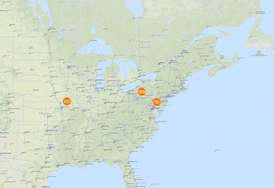
 |
| Fact: 30% of hiking app screenshots are Yosemite. |
Gaia GPS displays a variety of image and vector based data sources. It’s popular among the backpacking and off roading communities. It can work without a network and is very careful with battery.
Let’s move on to one of the key features for nearly every map app: Image Tiles.
Image Tiles
A basic feature required for map display is loading and rendering of image tiles. We’ve moved well beyond Web Map Service on mobile devices and we now expect tiles. This might be a Web Map Tile Service (WMTS), but is more likely to be a fixed quad tree of tiles like that coming from Google Maps or OpenStreetMap.

Efficient image tile loading is a tricky problem. Mobile devices have network constraints and we want to make careful use of data caching. WG-Maply can handle this for both globe and map, but there’s an interesting variant for the map case.

In the example we’re loading three levels of tiles based on the current window. We start with an extremely low resolution, then overlay that with slightly higher resolution and finally toss in the proper resolution. It gives the user something to look at while the system loads the good stuff.
Tricks like these are important to efficient map display on mobile, but let’s take a quick detour through some really basic functionality.
Vectors, Labels and Markers
Any credible map toolkit should be able to display some basic features and WhirlyGlobe-Maply is no exception. These include vectors for areal and linear features, labels for points and of course markers.

All very simple to us. Vectors, for example can be consumed from a variety of data sources, like GeoJSON or (ESRI Shapefile). Labels and markers are 2D features and can interact through an adaptive layout engine. All of them provide selection feedback too.
It’s what the developers do with these features that gets interesting. That leads us to a complex modern feature: vector tiles.
Vector Tiles
Mapbox has popularized vector tiles with their OpenStreetMap data set. Theirs is a Google Protobuf based format, which is as complex as it sounds. The fundamental ideas are simpler.
Vector tiles are to image tiles as vectors are to images. They are just chopped up geometry representing what’s in each map tile. You can use them much more flexibly than images.
 |
| A very custom example of vector tiles. |
Believe it or not, National Geographic World Atlas uses vector tiles hosted by Mapbox. The rest of it is completely custom. And, okay, it's technically a globe. But if National Geographic doesn’t have some cartographic street cred, nothing does.
 |
| A more normal use of vector tiles. |
The Gaia GPS developers use vector tiles they generate themselves to draw contour lines. The data is styled using Mapnik XML which is associated with the Mapnik map renderer. Gaia GPS also has a street layer based on the same approach.
WhirlyGlobe-Maply has vector tile support down solid, but style support is still in flux and likely to be for a while. We can support older style formats like Mapnik XML and developers can always go off on their own. Newer formats like Mapbox GL Style Sheets are not fully supported yet. We also hope to add in Styled Layer Descriptor since it's an actual standard.
Vector Tiles are a bit trippy so let’s go back to some more basic map features.
Wide Vectors
Widened vectors are one of those obvious things that require some work to implement. OpenGL ES has a basic line implementation, but it looks kind of... meh. If you want lines that have smooth edges and neat little joins, you need something more.

WhirlyGlobe-Maply's implementation involves a custom OpenGL ES shader and a bit of math. Line intersections are calculated on the fly (sort of) and width can be varied as needed. Typically this just looks like constant width lines as the user moves in and out.
 |
| Look deep into my shader |
Oh, and you can do dashed lines and other effects. Wide vectors work both on the flat map and the globe, but they're primarily a map feature, just like the next one: clustering.
Marker Clustering
Clustering markers is a pretty simple idea. When you have a lot of markers on your map, it can look bad. Best to gather them up into groups and display the groups.

Simple enough, but our maps move so we have to do something more. As the user zooms in, the groups come apart and as zoom move out, the groups form. It’s tricky to implement, but looks quite nice.
In truth, clustering can be used on both the globe and the map even it’s nominally a map feature. Let’s look at something purely from the 2D map.
Infinite Scrolling
For certain types of map projections, the extreme west and east extents represent the same point (really, line). This means the user expects to move the map and have it wrap around.
 |
| Bonus question: What about wrapping top to bottom? |
Infinite scrolling is simple in concept, but tricky to implement. The rendering isn’t bad, but when you add in feature selection and overlaid data it gets interesting. You know what else is interesting? Map projections.
Map Projections
The real test of a map toolkit is whether it handles explicit map projections. Actually, that’s not true. Plenty of map toolkits only work in a simple map projection, known as web mercator. But if you want to hold your head high in a room full of cartographers, you should have map projection support.
 |
| Does this projection make my poles look big? |
Web mercator, shown here, is the most common projection in use on mobile. It has its problems, particularly near the poles. We can thank Google Maps’ dominance for this affront to cartography. There's data in plenty of other projections and good reason to use them.

From left to right we’ve got:
- A data source in British National Grid overlaid on a web mercator map.
- The same data source overlaid on a British National Grid map. The web mercator data source is being reprojected.
- The same thing on a globe. Because it looks cool.
Though the vast majority of our users will always use web mercator, WhirlyGlobe-Maply can do more. It uses the Proj.4 coordinate system package internally and can handle a variety of useful map projections.
Conclusion
Map toolkits for mobile devices are hot right now. There are a number of excellent ones, though most are tied to specific data services like Apple or Google or are proprietary or both. A few are open source, like WhirlyGlobe-Maply.
We’ve discussed some basic features and a few advanced ones we consider essential for map display on mobile. If you’re looking to build an app, we hope you’ll look beyond the proprietary services to something like WhirlyGlobe-Maply.
Special thanks to Stamen for the Stamen Watercolor map tiles, derived from OpenStreetMap data, used in many of these examples.


